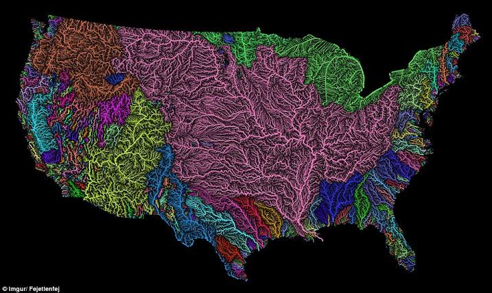
Should’ve organized them alphabetically too
Much better to organize it by water systems, with some additional divisions for the Mississippi system ans consolidation of smaller systems not seperated by mountain ranges.

Edit: (Image credit: Robert Szucs, Fejetlenfej/Imgur)
What, kind sir, is the source of this beautiful piece of mappery?
Seems to be this.
I found it with google image search for river map usa, but it was not from the original source, so I did not want to credit them.
No wonder it’s called the mighty Mississippi. It’s huge!
So the states get gradually smaller as you go north? Got it.
Yeah, I would have gone with straight lines, not these weird curved ones.
This somehow feels like a joke about map projections that would make its way into Futurama
That’s really high praise, thanks! Made my day.
Vermont’s huge now compared to before.
Some choices were definitely made here.
Delaware.
Where?
Delagone
Uh oh. Looks like someone messed with Texas.
Gerrymanderers hate this one trick…
I moved from Pennsylvania back home to Minnesota a decade ago. Didn’t expect it to move back to me.
Lol. California just became The State of Los Angeles
Ah yes Nevada, famous for its coast lines and the bay area
I see we’ve forgotten our non-contiguous siblings.
But more to the point, why not just arrange them alphabetically while we’re here?
I’m not sure which state is furthest from it’s original position, but Indiana seems quite far from home.
Delaware is in the U.P.
Kentucky took a pretty big trip, but New Jersey is the funniest to me. At least it still gets an eastern coast.
Connecticut borders Alabama, but I guess it still has Massachusetts
This hurts.
I love this map. It breaks my brain in so many ways!
Can’t believe someone finally won the Toledo War. Really didn’t expect it to be Rhode Island
tears up gambling ticket
Arkansas straight up deleted from existence.
Edit: it’s west of Oklahoma!
It’s in West Texas
Ha you’re right thanks, I just missed it. I saw Oklahoma and didn’t look carefully to the west of it - I think I have been conditioned by the clearly inferior maps we’ve been using.
It’s clearly north of Texas??
We are just gonna give South Carolina the outer banks? No. Redraw these lines, pls thnx
South Carolina is Worst Carolina and they deserve nothing but the highway that runs through the state so people can get out quickly.
IMO we can just delete it. No one will notice.


