
- cross-posted to:
- istoria
- cross-posted to:
- istoria
article from September 2025
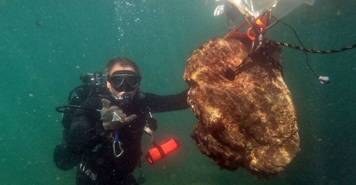
“The goal of the second stage of the research was to establish the boundaries of the port area to the late antique fortress of Erite, as well as to map important underwater elements – rocks, reefs and concentrations of movable cultural property,” the museum said.
The fortress of Erite itself is marked on the famous ancient map Tabula Peutingeriana. According to the data in it, along the Black Sea coast within the province of Moesia Inferior, there were road stations, including Odessos (Varna), Erite (at the mouth of the Kamchia River) and Templum Jovis (probably near the present-day city of Obzor). All three were important port centres, located directly on the seashore or at the mouth of rivers – that is, safe harbours.
Among the earliest finds are three stone anchors with one hole, which can be dated to the beginning of the 1st millennium BCE at the earliest.
You must log in or # to comment.