It’s still a Mercator projection if you take any part of a map projected thusly. (And there’s the “modified universal transverse Mercator” that, I think, is that with some grid offset.)
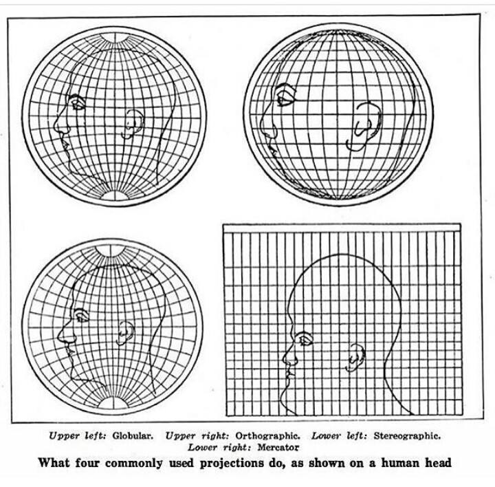
But, see my edit, this image isn’t doing that. It’s stretching a “picture of half a face superimposed on a larger half globe,” not the half-face as if the head were the globe.
Projections don’t have to be limited to the entire earth. You can subset the area represented and still apply a projection. (Though you do have a decision if you’re taking an arc-area to “re-align” your projecting shape so that it best fits your area. But that might be more complicated than you’re looking for, other projections best suited for your locale would be a better fit)


Possibly. I asked (and no one’s answered yet, so I still don’t know) if it’s still a Mercator projection if you vertically bisect a map of the Earth.
It’s still a Mercator projection if you take any part of a map projected thusly. (And there’s the “modified universal transverse Mercator” that, I think, is that with some grid offset.)
But, see my edit, this image isn’t doing that. It’s stretching a “picture of half a face superimposed on a larger half globe,” not the half-face as if the head were the globe.
Yes. Why wouldn’t it be?
Projections don’t have to be limited to the entire earth. You can subset the area represented and still apply a projection. (Though you do have a decision if you’re taking an arc-area to “re-align” your projecting shape so that it best fits your area. But that might be more complicated than you’re looking for, other projections best suited for your locale would be a better fit)